Light and Landscapes

John Caplis Photography

  • Featured Images
  • Landscapes
    • International
      • Ireland
        • Coastlines
          • Cobh
          • Dingle Peninsula
          • Kilkee Cliffs
          • Cliffs of Moher
          • The Cliffs at Slieve League
          • Malin Head
          • Fanad Head Lighthouse
        • Castles and Ring Forts
          • Cahir Castle
          • Dun Aengus Fort, Aran Islands
          • Grianan Of Aileach
          • Kerry Peninsula
        • Dublin
          • Walkabout in Dublin
        • Religious Sites
          • High Crosses of Clonmacnoise
          • Kilfenora
          • Kilkenny
          • Killilagh Church and Graveyard
          • Monasterboice
          • Muckross House and Abbey
          • Dunlewey and the Poisoned Glen
        • Megalithic Tombs
          • The Burren
          • Newgrange
        • Mountains and Streams
          • Connemara
          • Rearcross
          • Torc Waterfall
      • Northern Ireland
        • Along the Antrim Coast
        • Urban Landscapes from “The Troubles”
      • Canadian Rockies
        • Frozen Bubbles on Abraham Lake
        • Glacial Lakes and Rivers
        • Canoes of the Canadian Rockies
      • Norway
        • Winter in the Lofoten Islands, Norway
        • Northern Lights Over the Lofoten Islands, Norway
      • Puerto Rico
        • Crash Boat Beach
        • El Yunque Rainforest
        • Old San Juan
    • Mid Atlantic
      • District of Columbia
        • Cherry Festival
        • Cherry Blossom Panoramics
        • Fall at the National Mall
        • Kenilworth Aquatic Gardens
        • Library of Congress
        • Korean War Memorial
        • Lincoln Memorial at Sunrise on the Spring Equinox
        • National Cathedral – Stained Glass Light
        • National Cathedral, Stained Glass Light – Part II
      • Virginia
        • Fall on Bull Run Mountain
        • Great Falls National Park
        • Great Falls Kayak Race
        • More Great Falls Kayak Racing
        • James River Arch Train Bridge
        • Luray Caverns
        • On Wellington Pond
        • Burnside Farms Festival of Spring
        • Summer of Sunflowers at Burnside Farms
        • White Oak Canyon
      • Great Smoky Mountains
      • West Virginia
        • Fall Color in the Highlands
        • More Color in the Highlands Pt II
        • Fall Color in the New River Gorge
        • Winter Waterfalls
    • Southwest
      • Arizona
        • Lower Antelope Canyon
        • Upper Antelope Canyon
        • Canyon X
        • Monument Valley
        • Petrified Forest National Park
        • Spider Rock, Canyon De Chelly National Monument
        • White Pocket, Arizona
      • California Desert
        • Death Valley
          • Aguereberry Point
          • Badwater Basin
          • Death Valley Mud Flats
          • Mesquite Flat Sand Dunes
          • Zabriskie Point
        • Alabama Hills
        • California Desert in Black and White
        • Joshua Tree
      • Utah
        • Arches NP
        • Bryce Canyon NP
        • Coral Pink Sand Dunes State Park
        • Deadhorse State Park
        • Island in the Sky, Canyonlands NP
        • Needles District, Canyonlands NP
        • The Narrows, Zion NP
      • New Mexico
        • Bisti Badlands, NM
        • More Bisti Badlands
        • Ah Sli She Pah Wilderness
        • De Na Zin Wilderness
        • White Sands National Monument
      • Nevada
        • Valley of Fire State Park
          • Fire Wave and Pastel Canyon
          • White Domes
          • Windstone Arch
      • Texas
        • Salt Basin Dunes, Guadalupe Mountains NP
    • Pacific Northwest
      • Alaska
        • Denali – The Mountain
        • Fall Colors on the Tundra, Denali NP
        • Park Entrance in Fall
        • Toklat River, Denali NP
      • Washington State
        • Hoh Rain Forest, Olympic NP
        • Olympic National Park Beaches
        • Snowqualmie Pass
        • Mount Rainier, Washington
    • Yellowstone
      • Winter Landscapes
    • Southeast
      • Cypress Swamps in the Fall
      • Miami Beach
        • Art Deco on Ocean Drive
        • Classic or Hot Wheels?
        • Lifeguard Chic
      • New Orleans
        • A Night in the Big Easy
        • Destrehan Plantation
        • New Orleans: Cities of the Dead
    • New England
      • Devils Hopyard State Park
    • Nightscapes
      • Astrophotography
        • Milky Way Reflections
        • Outer Banks, North Carolina
        • Starlight Silhouettes
      • Fireworks
        • Fireworks over the Manassas Train Station
        • Independence Day Fireworks at George Washington’s Mount Vernon
        • Independence Day Fireworks on the National Mall
        • Williamsburg Grand Illumination
        • Sunflowers and Fireworks at Burnside Farms
      • California at Night
      • Chicago at Night
      • DC at Night
      • Northern Lights Over the Lofoten Islands, Norway
  • Wildlife
    • Animal Kingdom
    • Wildlife in the Fall, Denali NP
    • Where the Buffalo Roam
    • Winter Wildlife in Yellowstone
  • Infrared Photography
    • Infrared Favorites
    • Historic Manassas in Infrared
    • New Mexico In Infrared
    • Northern Ireland in Infrared
    • Savannah in Infrared
    • Sunflowers in Infrared
    • Vintage LIfe in Infrared
  • Vintage Life
    • Steam Locomotives
    • Truck Graveyards
  • Search
  • My Info
  • Light and Landscapes Blog
  • John Caplis Photography on Facebook
  • John Caplis on Facebook
  • Ordering Prints

Recent Posts

  • Chasing the Light in Lower Antelope Canyon
  • Sunset at Horseshoe Bend, Glen Canyon National Recreational Area
  • The Otherworldly Landscapes of White Pocket, Vermilion Cliffs National Monument
Home » Photo Galleries » Landscapes » International » Northern Ireland » Urban Landscapes from “The Troubles”

Urban Landscapes from “The Troubles”

“The Troubles” is the common name for the violent conflict in Northern Ireland from 1968 until the the Good Friday Agreement in 1998.  Portions of the urban landscapes in Derry and Belfast serve as artistic landmarks and powerful reminders of this dark period.    Free Derry  is a historical area that was a self-declared autonomous nationalist area from 1969 and 1972.  Its surrounding streets were the scene of the Battle of the Bogside in 1969 and Bloody Sunday in 1972.   Today, gigantic, visually stunning murals throughout this area memorialize political prisoners and victims claimed by the fighting.   Another reflection of this still-mending societal divide are the Peace Walls, a series of barriers that often separate Republican-Nationalist-Catholic neighborhoods from Loyalist-Unionist-Protestant neighborhoods in Belfast, Derry, and other cities in Northern Ireland.  First erected in 1969, the walls remain today in the place many call home.   

IMG_1613

In 1969, the \"Free Derry\" wall was painted white with \"You are now entering Free Derry\" in black lettering. The area in front of the wall became known as Free Derry Corner by the inhabitants.
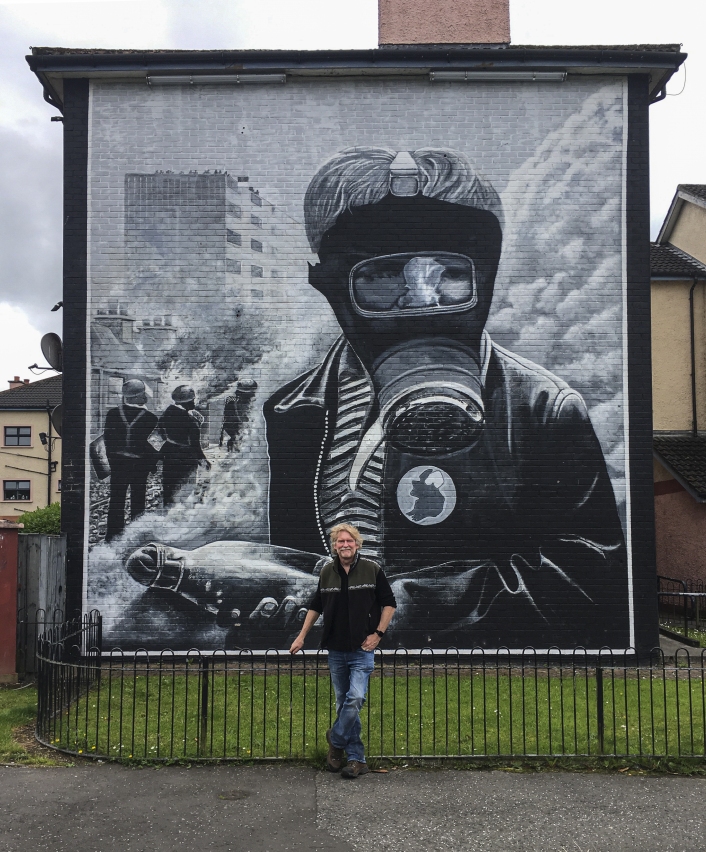
IMG_1615-copy

The above mural depicts the \'Battle of the Bogside\'. It shows a young boy in a gas mask holding a petrol bomb fashioned from a milk bottle. The mural was painted in 1994 for the 25th anniversary of the incident.
IMG_1622

IMG_1640-copy

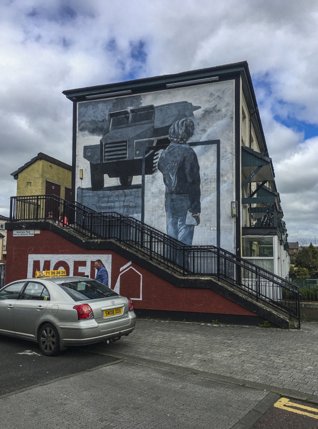
Mural of a republican nationalist youth facing an armored British Army vehicle.

IMG_1628-copy

IMG_1635-copy

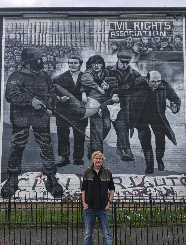
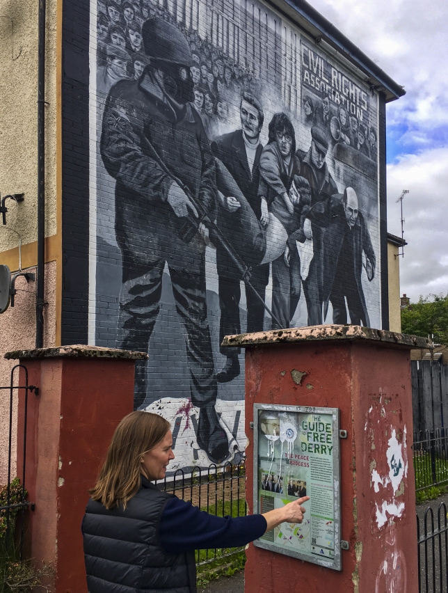
Mural of the Bloody Sunday Massacre, where the British Army opened fire on a Civil Rights demonstration and killed 14 people. A group of men, led by a local priest, carry the body of the first fatality of the day
IMG_1639-copy-crop

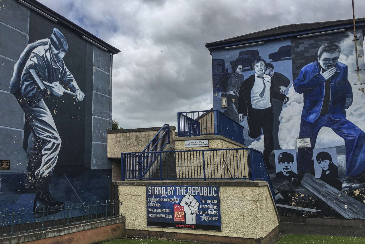
‘Free Derry’ ended when the British army moved in to the area and removed the barricades. To the left, a mural depicts a British Soldier breaking down a door with a sledgehammer. On the right, people are running from tear gas that has been fired.
IMG_1641-copy

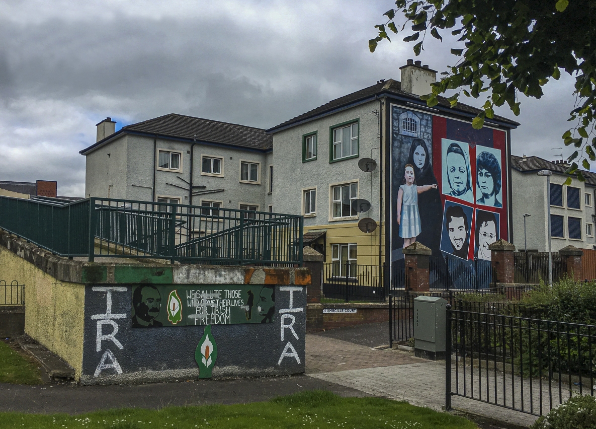
A mural honoring relatives of a hunger striker. The little girl is pointing towards the Peace Mural on another building., which represents a symbol of hope for a peaceful future.
IMG_1798-copy

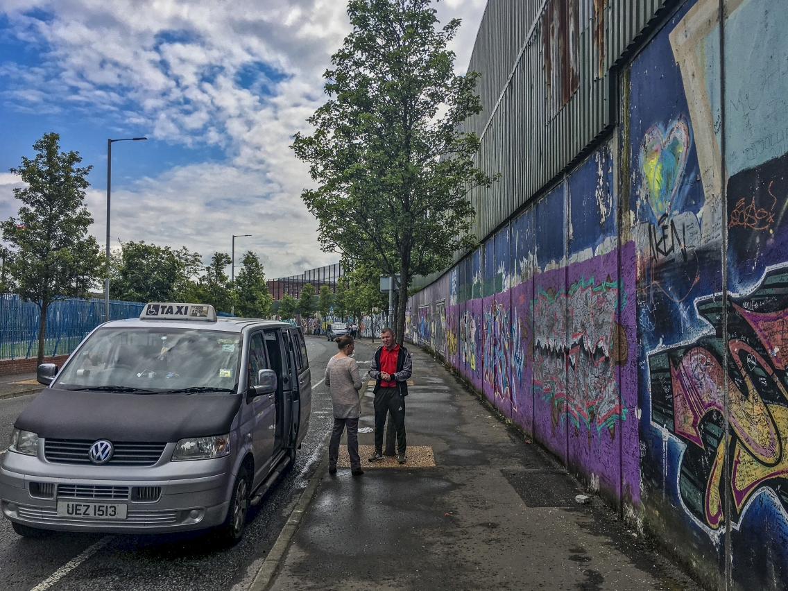
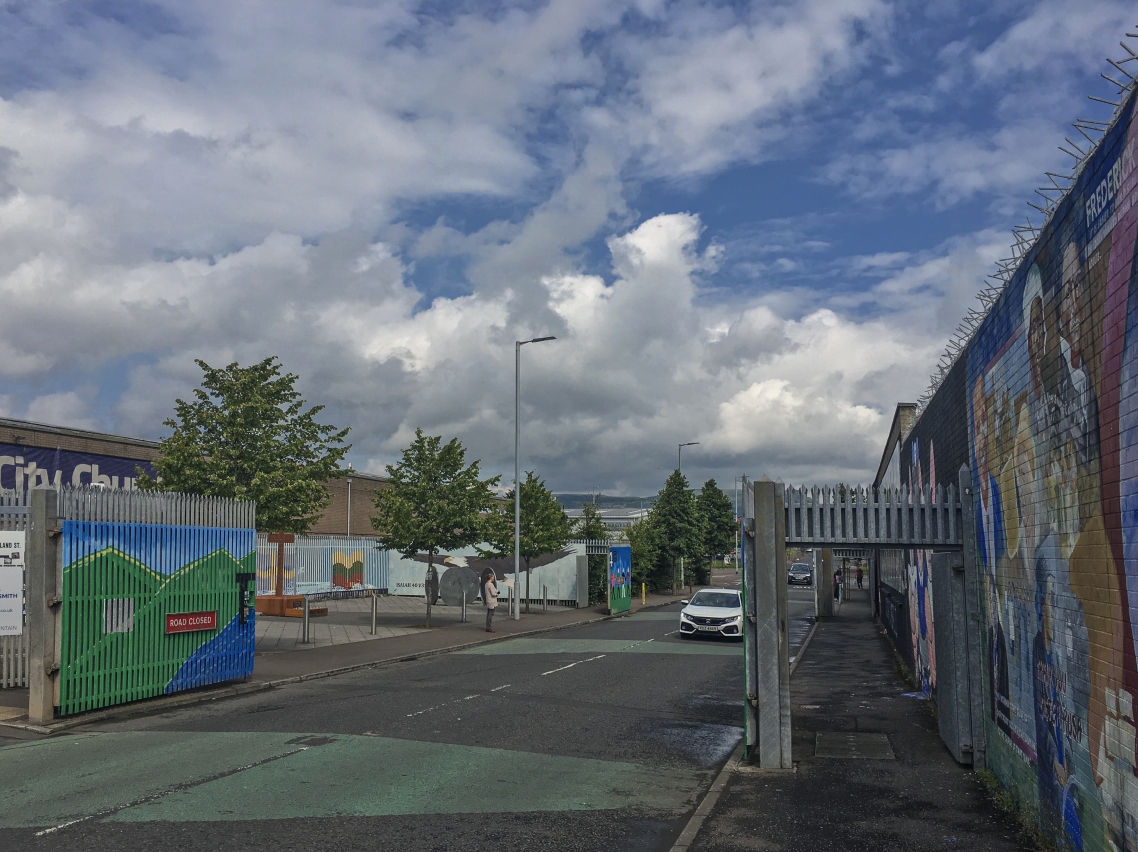
The Peace Wall in Belfast between the Shankills Road and Falls Road neighborhoods.

IMG_1790-copy

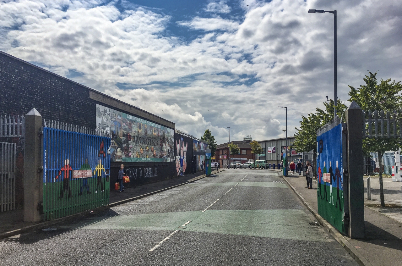
At the height of the troubles, the gates in the Peace Walls were used as security checkpoints.

IMG_1789-copy

Some of these gates are still locked at night to control the movement of people who otherwise might cause trouble after dark.
IMG_1801-copy

Once serving as peace-keeping measures, the walls are now mostly a tourist attraction.  The sentiment expressed by our tour guide was that it will take another generation or two to heal the wounds of this turbulent past, and so for now, the barriers remain.

IMG_1791-copy

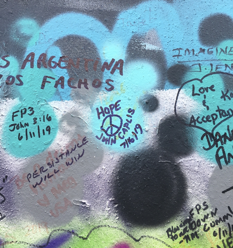
The wall is covered with murals, graffiti, and messages from visitors all over the world expressing hope for a peaceful future for Northern Ireland.

Related Images:

Share this:

  • Click to share on Facebook (Opens in new window) Facebook
  • Click to email a link to a friend (Opens in new window) Email
  • Click to share on Pinterest (Opens in new window) Pinterest

© 2025 · Light and Landscapes