Light and Landscapes

John Caplis Photography

  • Featured Images
  • Landscapes
    • International
      • Ireland
        • Coastlines
          • Cobh
          • Dingle Peninsula
          • Kilkee Cliffs
          • Cliffs of Moher
          • The Cliffs at Slieve League
          • Malin Head
          • Fanad Head Lighthouse
        • Castles and Ring Forts
          • Cahir Castle
          • Dun Aengus Fort, Aran Islands
          • Grianan Of Aileach
          • Kerry Peninsula
        • Dublin
          • Walkabout in Dublin
        • Religious Sites
          • High Crosses of Clonmacnoise
          • Kilfenora
          • Kilkenny
          • Killilagh Church and Graveyard
          • Monasterboice
          • Muckross House and Abbey
          • Dunlewey and the Poisoned Glen
        • Megalithic Tombs
          • The Burren
          • Newgrange
        • Mountains and Streams
          • Connemara
          • Rearcross
          • Torc Waterfall
      • Northern Ireland
        • Along the Antrim Coast
        • Urban Landscapes from “The Troubles”
      • Canadian Rockies
        • Frozen Bubbles on Abraham Lake
        • Glacial Lakes and Rivers
        • Canoes of the Canadian Rockies
      • Norway
        • Winter in the Lofoten Islands, Norway
        • Northern Lights Over the Lofoten Islands, Norway
      • Puerto Rico
        • Crash Boat Beach
        • El Yunque Rainforest
        • Old San Juan
    • Mid Atlantic
      • District of Columbia
        • Cherry Festival
        • Cherry Blossom Panoramics
        • Fall at the National Mall
        • Kenilworth Aquatic Gardens
        • Library of Congress
        • Korean War Memorial
        • Lincoln Memorial at Sunrise on the Spring Equinox
        • National Cathedral – Stained Glass Light
        • National Cathedral, Stained Glass Light – Part II
      • Virginia
        • Fall on Bull Run Mountain
        • Great Falls National Park
        • Great Falls Kayak Race
        • More Great Falls Kayak Racing
        • James River Arch Train Bridge
        • Luray Caverns
        • On Wellington Pond
        • Burnside Farms Festival of Spring
        • Summer of Sunflowers at Burnside Farms
        • White Oak Canyon
      • Great Smoky Mountains
      • West Virginia
        • Fall Color in the Highlands
        • More Color in the Highlands Pt II
        • Fall Color in the New River Gorge
        • Winter Waterfalls
    • Southwest
      • Arizona
        • Lower Antelope Canyon
        • Upper Antelope Canyon
        • Canyon X
        • Monument Valley
        • Petrified Forest National Park
        • Spider Rock, Canyon De Chelly National Monument
        • White Pocket, Arizona
      • California Desert
        • Death Valley
          • Aguereberry Point
          • Badwater Basin
          • Death Valley Mud Flats
          • Mesquite Flat Sand Dunes
          • Zabriskie Point
        • Alabama Hills
        • California Desert in Black and White
        • Joshua Tree
      • Utah
        • Arches NP
        • Bryce Canyon NP
        • Coral Pink Sand Dunes State Park
        • Deadhorse State Park
        • Island in the Sky, Canyonlands NP
        • Needles District, Canyonlands NP
        • The Narrows, Zion NP
      • New Mexico
        • Bisti Badlands, NM
        • More Bisti Badlands
        • Ah Sli She Pah Wilderness
        • De Na Zin Wilderness
        • White Sands National Monument
      • Nevada
        • Valley of Fire State Park
          • Fire Wave and Pastel Canyon
          • White Domes
          • Windstone Arch
      • Texas
        • Salt Basin Dunes, Guadalupe Mountains NP
    • Pacific Northwest
      • Alaska
        • Denali – The Mountain
        • Fall Colors on the Tundra, Denali NP
        • Park Entrance in Fall
        • Toklat River, Denali NP
      • Washington State
        • Hoh Rain Forest, Olympic NP
        • Olympic National Park Beaches
        • Snowqualmie Pass
        • Mount Rainier, Washington
    • Yellowstone
      • Winter Landscapes
    • Southeast
      • Cypress Swamps in the Fall
      • Miami Beach
        • Art Deco on Ocean Drive
        • Classic or Hot Wheels?
        • Lifeguard Chic
      • New Orleans
        • A Night in the Big Easy
        • Destrehan Plantation
        • New Orleans: Cities of the Dead
    • New England
      • Devils Hopyard State Park
    • Nightscapes
      • Astrophotography
        • Milky Way Reflections
        • Outer Banks, North Carolina
        • Starlight Silhouettes
      • Fireworks
        • Fireworks over the Manassas Train Station
        • Independence Day Fireworks at George Washington’s Mount Vernon
        • Independence Day Fireworks on the National Mall
        • Williamsburg Grand Illumination
        • Sunflowers and Fireworks at Burnside Farms
      • California at Night
      • Chicago at Night
      • DC at Night
      • Northern Lights Over the Lofoten Islands, Norway
  • Wildlife
    • Animal Kingdom
    • Wildlife in the Fall, Denali NP
    • Where the Buffalo Roam
    • Winter Wildlife in Yellowstone
  • Infrared Photography
    • Infrared Favorites
    • Historic Manassas in Infrared
    • New Mexico In Infrared
    • Northern Ireland in Infrared
    • Savannah in Infrared
    • Sunflowers in Infrared
    • Vintage LIfe in Infrared
  • Vintage Life
    • Steam Locomotives
    • Truck Graveyards
  • Search
  • My Info
  • Light and Landscapes Blog
  • John Caplis Photography on Facebook
  • John Caplis on Facebook
  • Ordering Prints

Recent Posts

  • Chasing the Light in Lower Antelope Canyon
  • Sunset at Horseshoe Bend, Glen Canyon National Recreational Area
  • The Otherworldly Landscapes of White Pocket, Vermilion Cliffs National Monument
Home » Photo Galleries » Landscapes » Southwest » Texas » Salt Basin Dunes, Guadalupe Mountains NP

Salt Basin Dunes, Guadalupe Mountains NP

Occasionally, I enjoy visiting things that are “off the beaten path”, or in this case, totally “off the grid”. I also have a “thing” for photographing desert sand dunes. The Salt Basin Dunes section of the Guadalupe Mountains NP scratches both of those itches. Located in a remote area of the New Mexico-Texas border, it is far, far away from anything that resembles a modern urban area. While the map shows the town of Dell City nearby, it is in reality little more than an agricultural community, and offers travelers nothing more than a convenience store, and one cafe, which was only open during lunch hour (at least on the day we passed through). Driving east out of Dell City on several gravel/dirt roads for about 12 miles, you reach a solitary trail head.

The dune field is made of gypsum, similar to White Sands National Monument, but the Salt Basin is a much smaller size in area. The dunes themselves are also much smaller in stature, and there is much more vegetation growing amongst the dunes than you will find at White Sands. This makes hikes and photography in the Salt Basin a much different experience from a visit to White Sands.

One the day of our visit, the winds were blowing quite hard, and airborne dust and sand made anything on the distant horizon appear very hazy. When we first saw the Salt Basin from Dell City, it looked like a white hazy sandstorm, and we thought our visit might be a bust. Once we made it to the Salt Basin, however, visibility around the dunes was sufficient for navigating around and taking photos. You still had to deal with stinging wind blasts of sand, and it was best to keep your camera and lenses covered up when not making an image. It did provide the added bonus of wiping the dunes free of footprints from humans, revealing pristine textures and ridges on the sand. We were the only people at the dunes that day, making for a nice wilderness-like experience.
2F7A9274 web

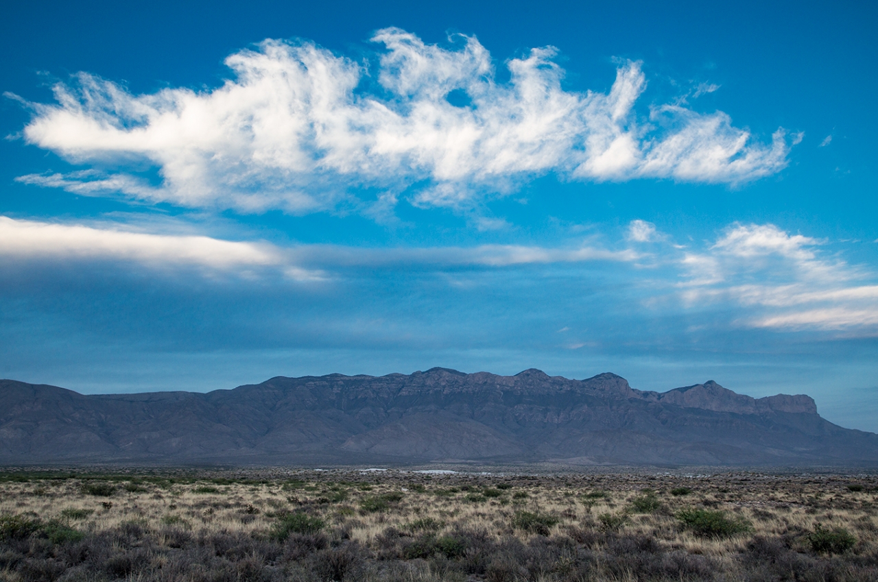
If you look closely, you can see a small sliver of white at the foot of the Guadalupe Mountain range. This is the setting for the Salt Basin Dune field. To get to the dunes, you must hike about a mile of dirt track through grass and brush from the trail head. The trail head is located off a small parking area at the end of Williams Road, which also has an outdoor restroom and a covered picnic area.
2F7A9171 copy web

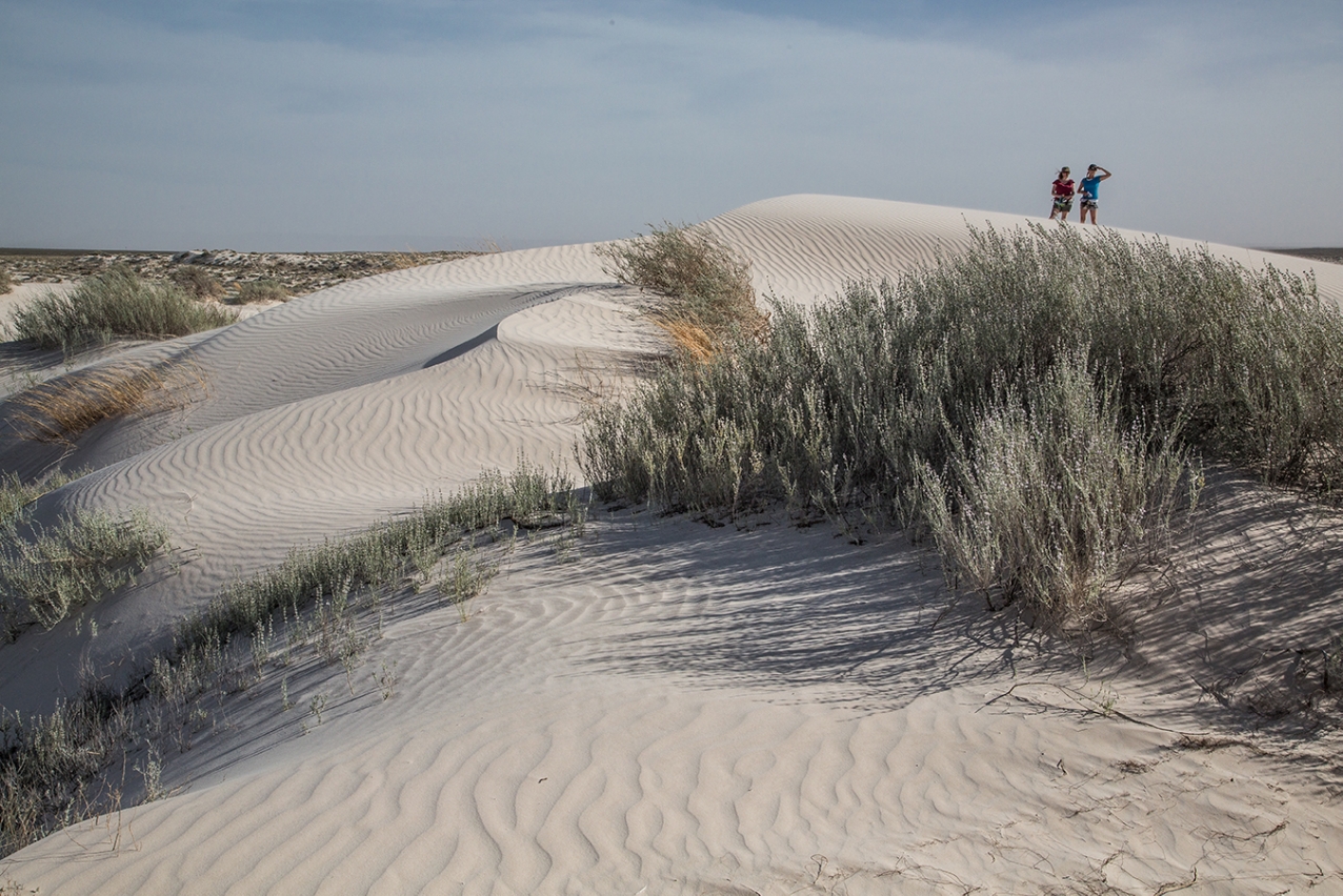
My hiking family companions, standing on one of the taller ridges in the dune field. The park officially lists the height of the dunes as ranging from 3 ft to 66 ft.
2F7A9210 crop web

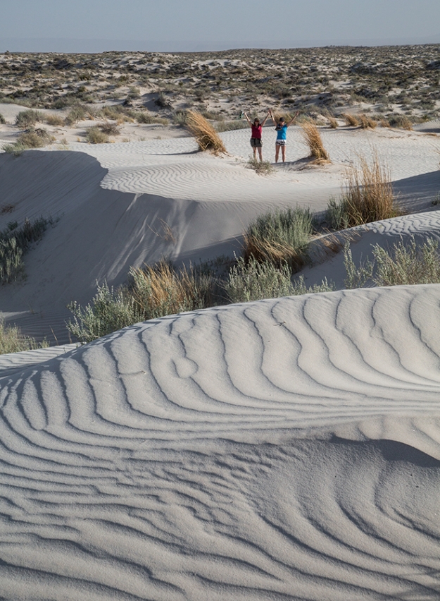
A hike through the dune field revealed many interesting dune shapes, including this humpback dune and plateau area.
2F7A9175 copy 2 web

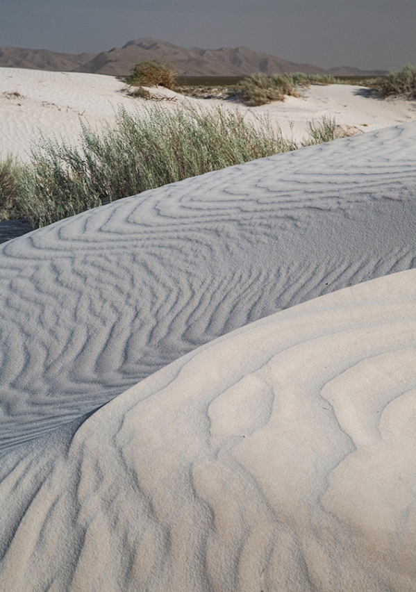
Smaller dune shapes and textures made for some very interesting layered images when using a longer focal length (88 mm).
2F7A9182 copy web

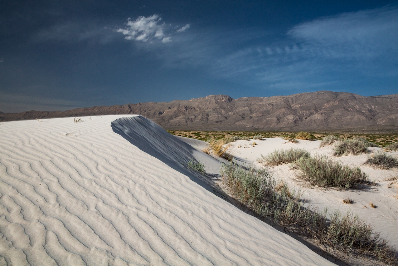
Ridges along the top of a dune looking northeast toward the Guadalupe Mountains.

2F7A9248 copy web

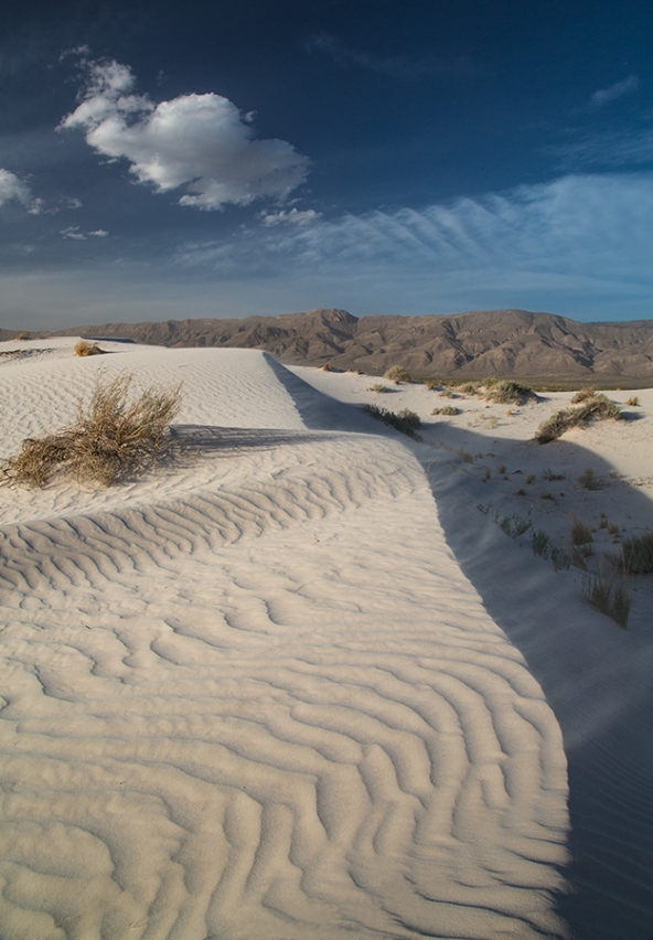
I experimented with different shutter speeds and exposure times to see what would capture the motion of the sand blowing across the dunes. This is a short exposure (1/125 second) showing the blowing sand going over the edge of the dunes. If you look on the shadowed, curved edge of the dune top, you can see faint, wispy fingers of sand blowing over the edge.
2F7A9251 copy web

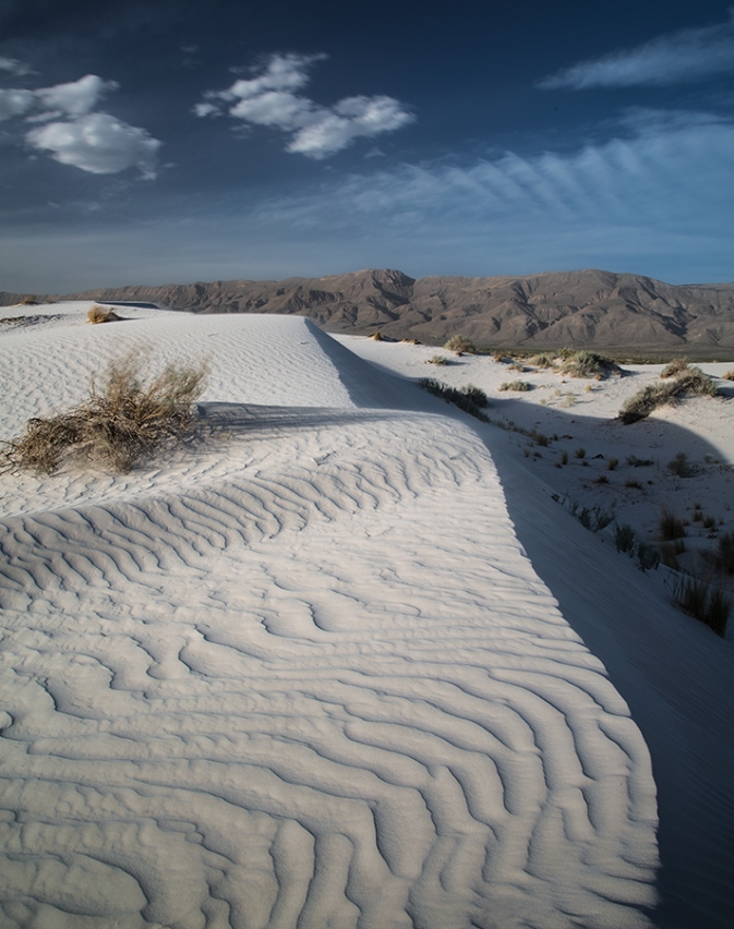
A longer exposure removed any visible evidence of blowing sand over the top of the dune (5.0 seconds). The white color of gypsum is more evident, and the ridges on the dunes are more pronounced, as they are no longer softened by the appearance of sand moving across the dune.
Salt Basin Dunes Panorama_224_225 web

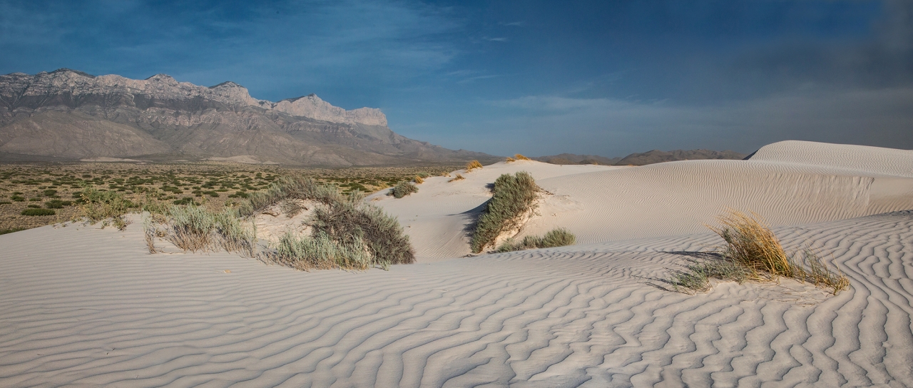
One of my objectives on this visit was to capture the dune field, with its sand ridge textures and shadows in the foreground, and the El Capitan rock formation in the background. I was able to capture this panoramic shot looking southeast over the edge of the dunes with the Guadalupe Mountain range and El Capitan in the background
Related Images:

Share this:

  • Click to share on Facebook (Opens in new window) Facebook
  • Click to email a link to a friend (Opens in new window) Email
  • Click to share on Pinterest (Opens in new window) Pinterest

© 2025 · Light and Landscapes